9 KINSMAN ST
Owner Information
GRIFFIN PATRICK
9 KINSMAN ST
BEVERLY, MA 01915


Property Details
9 KINSMAN ST is classified as a Single Family Residential (Colonial).
The primary structure on this property was built in 2018. There are 2,128ft2 of built area within this property. There is 2,128ft2 of residential/living space within this property. This property is listed as having 8 rooms.
9 KINSMAN ST is valued at $680,300. The land is valued at $266,100 and the structures are valued at $414,200.
This property is in Zone R10. Confirm with local Zoning Board authorities to ensure there are no overlays or other easements on this property.
The most recent deed for 9 KINSMAN ST is recorded at the local registrar in Book 37489, Page 49. 9 KINSMAN ST was last sold on Friday, May 3, 2019 for $637,500.
Assessment data from fiscal year 2022.
Flood Data
According to the FEMA National Flood Hazard Layer, this property does not appear to be in a flood zone. It may also be in an area not yet reviewed. Nonetheless, confirm this information prior to taking any action.
To view the flood hazards around this property, create a FEMA "Firmette" Map of the area around 9 KINSMAN ST.
Broadband Internet Providers
| Provider | Type | Bandwidth (mbps) | |
|---|---|---|---|
| HughesNet | Satellite | 25 | 3 |
| Verizon New England Inc. | DSL | 7 | 0 |
| VSAT Systems, LLC. | Satellite | 2 | 1 |
| Comcast | Cable | 1000 | 35 |
| GCI Communication Corp. | Satellite | 0 | 0 |
| Viasat Inc | Satellite | 100 | 3 |
Broadband service provider data from December 2020.
Adjacent Properties
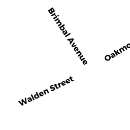
- 204 BRIMBAL AVE
Single Family Residential owned by LOCOCO FRANCESCO - 206 BRIMBAL AVE
Single Family Residential owned by ALBRIZIO JOSEPH A M - 208 BRIMBAL AVE
Single Family Residential owned by MURIEL J MCPARLAND 2021 REV TR - 11 KINSMAN ST
Single Family Residential owned by CRISAFI ROBERT A - 7 KINSMAN ST
Single Family Residential owned by MACDONALD FRANCES C